A swift and significant blow: Major winter storm targets northeast
02/11/2026 / By Willow Tohi
- A fast-moving winter storm is forecast to deliver up to 7 inches of snow across the Northeast.
- Winter weather advisories are active in seven states: New York, Connecticut, Massachusetts, Vermont, New Hampshire, Pennsylvania, and Maine.
- The heaviest snowfall, with rates up to an inch per hour, was expected during the Tuesday evening commute.
- Hazardous travel conditions are anticipated, potentially impacting the morning commute and school schedules for the rest of the week.
- Meteorologists warn that rapid accumulation could overwhelm road crews, creating a significant travel hazard.
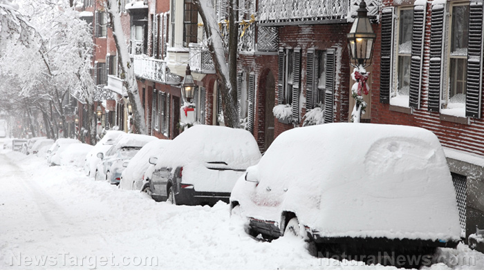
A potent winter storm is delivering a swift and disruptive punch to the Northeastern United States, with meteorologists warning of heavy snow that is stranding commuters and disrupting emergency services. The National Weather Service has issued winter weather advisories across seven states—New York, Connecticut, Massachusetts, Vermont, New Hampshire, Pennsylvania, and Maine—as a fast-moving system threatens to drop up to 7 inches of snow in some areas. With snowfall rates predicted to reach one inch per hour or more, the storm presents a formidable challenge for road crews and commuters alike, underscoring the region’s perennial vulnerability to sudden winter onslaughts.
The Forecast: Widespread Advisories and Heavy Accumulation
The National Weather Service expanded its initial batch of advisories overnight, reflecting the storm’s broadening impact. The entire state of New Hampshire is under a winter weather warning, with the most widespread advisories in the region. The heaviest snow is forecast for specific counties in New York and Vermont, where totals could reach 7 inches. Elsewhere, including parts of New York, Connecticut, and Massachusetts, a mix of lighter snow and a glaze of ice is expected, creating particularly treacherous “black ice” conditions on roadways.
The timing of the storm is particularly problematic for infrastructure and public safety. Snow was expected to begin in the early afternoon on Tuesday, with the most intense rates coinciding with the evening rush hour. The National Weather Service office in Burlington, Vermont, explicitly warned that the heaviest snowfall will occur during the evening commute, likely yielding slow and dangerous travel. Impacts are projected to linger into Wednesday, especially in northern and eastern parts of Maine and in higher-elevation areas where snow will take longer to taper off.
The Northeast’s Winter Vulnerability
This storm, while forecast to be relatively brief, taps into a deep-seated historical reality for the Northeast: its acute susceptibility to disruptive winter weather. The region’s dense population corridors, reliance on major interstate highways like I-95 and I-90, and complex network of commuter transit systems mean that even moderate snowfall can cause outsized economic and logistical disruption. Historical events like the Blizzard of 1978 or the more recent “Snowmageddon” of 2010 are extreme examples, but they highlight how snowfall intensity and timing—especially during peak travel hours—can rapidly overwhelm preparedness and response systems.
The warning from AccuWeather’s senior vice president, Jonathan Porter, that snow may fall faster than plows can clear it, is not merely operational but speaks to a core resilience challenge. It echoes lessons from past storms where rapid accumulation led to vehicles stranded on highways, critical delays in emergency services, and cascading transportation failures. This event serves as a contemporary test of the region’s ongoing efforts to improve forecasting communication, preposition resources, and manage public preparedness for swift-hitting storms.
The Ripple Effects: Travel, Schools, and Daily Life
The immediate consequences of the storm will be felt most acutely on the roads. Multiple National Weather Service offices have uniformly advised the public to plan for slippery road conditions and significant travel delays. The hazardous conditions have left school districts across the affected states in a familiar state of suspense, weighing whether to close, delay openings, or proceed as normal. As Derek Schroeter, a meteorologist with the NWS office in Gray, Maine, noted, the outcome for school schedules hinges on the precise track of the storm and the ability of road crews to clear secondary routes before buses begin their runs.
Beyond the commute, the storm threatens to disrupt commerce, flight schedules at major hubs like Boston Logan International Airport, and daily routines for millions. The advisory map, highlighting a swath of purple-blue from Pennsylvania to Maine, visualizes the broad footprint of this system. Major population centers within the advisory area include Boston, Massachusetts; Burlington, Vermont; Portland, Maine; Manchester, New Hampshire; Hartford, Connecticut; and Syracuse and Binghamton in New York.
Preparedness and Perspective
In response to the forecasts, state and municipal transportation departments are likely mobilizing fleets of plows and salt spreaders. The public is urged to monitor updates from local meteorologists and officials, consider adjusting travel plans, and ensure vehicles are prepared for winter driving conditions. While snowfall totals in this event may not break records, the combination of timing, rate, and geographic scope ensures its impact will be widely felt.
Bracing for the Onslaught
As the first flakes began to fall Tuesday afternoon, the Northeast once again confronted the formidable power of a winter storm. The coming hours will reveal whether road crews can keep pace with the predicted intense snowfall rates and if the public heeds warnings to avoid unnecessary travel. This storm is a stark reminder that in an era of advanced forecasting, the fundamental challenges of winter—safe travel, maintained infrastructure, and community resilience—remain persistent tests. The region now watches, waits, and prepares for a snowy, slippery, and significant test of its winter readiness.
Sources for this article include:
")
Submit a correction >>
Tagged Under:
big government, blizzard, chaos, climate, Collapse, Dangerous, disaster, ecology, environment, national security, panic, preparedness, SHTF, survival, weather terrorism
This article may contain statements that reflect the opinion of the author
RECENT NEWS & ARTICLES